 |
 |
| Steppes | Glaciers |
 |
 |
| Lakes | Mountains |
 |
 |
| Sheep | Guanaco |
 |
 |
| Steppes | Glaciers |
 |
 |
| Lakes | Mountains |
 |
 |
| Sheep | Guanaco |
Patagonia is the geographic region occupying the southernmost portion of South America. It covers both the south of Argentina and Chile, with the Andes mountains to the west and south, and plateau and low plains to the east. Magellan first used the word patagon to describe the native people whom he thought to be giants. These natives were indians with an average height of 1.80 m compared to the 1.55 m average for Spaniards of the time, so they appeared to be giants.
The Argentine portion of Patagonia includes the provinces of Neuquén, Río Negro, Chubut, Santa Cruz, and Tierra del Fuego. The Chilean portion includes the southern part of the region of Los Lagos, and the regions of Aisén and Magallanes.
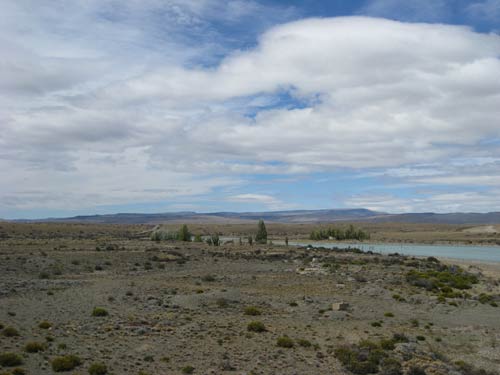
The Argentinean east of Patagonia is mainly vast wind swept steppe-like plains, rising in a succession of terraces, and covered with an enormous bed of shingle, and almost bare of any vegetation. As the plains approach the Andes the shingle gives place to granite and basalt lavas, animal life becomes more abundant and vegetation more luxuriant. The high rainfall against the western Andes and the low sea surface gives the ice-fields and glaciers, which are the largest in the Southern hemisphere outside of Antarctica.
The climate is less severe than might be expected. The east slope is warmer than the west, especially in summer, as a branch of the southern equatorial current runs along the coast, while the west coast is influenced by a cold current. At Puerto Montt the mean annual temperature is 11 °C and the average extremes 25.5 °C and -1.5 °C , whereas at Bahia Blanca near the Atlantic coast of Patagonia the mean annual temperature is 15 °C. At Punta Arenas, in the very south, the mean temperature is 6 °C. The prevailing winds are westerly, and the westward slope has a much heavier rainfall than the eastern in a rain shadow effect.
Vegetation. Due to the wide variation in temperature, rainfall and altitude, there are differnt vegetation patterns. Moorland with bogs and dwarf shrubs, termed Magellanic moorland, are typical along the south western coast. Around the ice-fields, high rainfall allows mixed evergreen temperate rain forest (Magellanic subpolar forests) of southern beech (Nothofagus betuloides). Mixed deciduous woodland (Valdivian temperate rain forests) is found in areas of lower precipitation.
Calafate berries and flowers
On the eastern side of the mountains on the wide steppe there is grassland with low shrubs, with tough Festuca tussock-grasses resistant to low precipitation and high winds. The calafate (Berberis buxifolia) is considered the symbol of Patagonia. An evergreen shrub, its berries are edible and used to make a traditional jam.
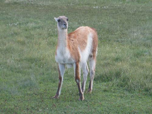
Fauna. The guanaco, the cougar, the zorro or Brazilian fox , the zorrino (a kind of skunk) are the most characteristic mammals of the Patagonian plains. The guanaco roam in herds over the country and with the rhea were formerly the means of subsistence for the natives, who hunted them on horseback with dogs and bolas.

Guanaco
Bird-life is abundant. The carrion-hawk is one of the characteristic objects of a Patagonian landscape; condoes soar in the mountains: long-tailed green parakeets as far south as the shores of the strait; hummingbirds may be seen flying amidst the falling snow. Among water-fowl are flamingo, the upland goose, and in the strait the steamer duck.
Marine fauna include the Southern right whale, the Emperor penguin, the Orca and elephant seals.
Chilean and Argentine expansion (1843-1902)
Chile and Argentina have sparred over Patagonia since the mddle of the 19th century. Bernardo O'Higgins, instructed the Chilean president at the time to send an expedition to the Strait of Magellan . They founded Fuerte Bulnes in 1843 and 5 years later moved the settlement to its current location of Punta Arenas, the oldest permanent settlement in Southern Patagonia. Punta Arenas made Chile's claim of the Strait of Magellan permanent.
In the 1870s Argentine government embarked on a controversial Conquest of the Desert campaign to subdue the native peoples of the South. By the mid-1880s the campaign's objectives had largely been achieved and most of the original natives were wiped out.
In 1885 a mining expeditionary party under the Romanian adventurer Julius Popper found gold in southern Patagonia in search of gold, and this opened up some of the area to prospectors.
European missionaries and settlers arrived through the 19th and 20th centuries, notably the Welsh settlement of the Chubut Valley. One can still see signs of the Welsh and Welsh culture in tthis area today.
In the beginning of the 20th century, the border between Chile and Argentina in Patagonia was established by the mediation of the British government. It has been modified since then, and there is still one place (50 km long) where there is no border established in the Patagonia Icefield.
Until 1902 most of Patagonia was settled by Chilotes who worked in cattle farming. around 1902, when the boundaries were drawn, a lot of these Chilotes were expelled from the Argentinia. They ended up in a part of Chile that lacked good grasslands for cattle farming on the forest-covered Chilean side. The immigrants burned down the forest, setting off fires that are some of the largest in the history of man - the resulting devastation can still be seen today over 100 years later.
One finds monuments to long forgotten border wars through the region.